Phone-Based LiDAR Is Coming for the Tape Measure: A Field Guide for Touring Crews and Warehouse Teams
Device LiDAR has quietly crossed the line from novelty to working tool. Here's what that means for road case measurement, pull sheets, and the digital twin every shop has been promising itself for a decade.

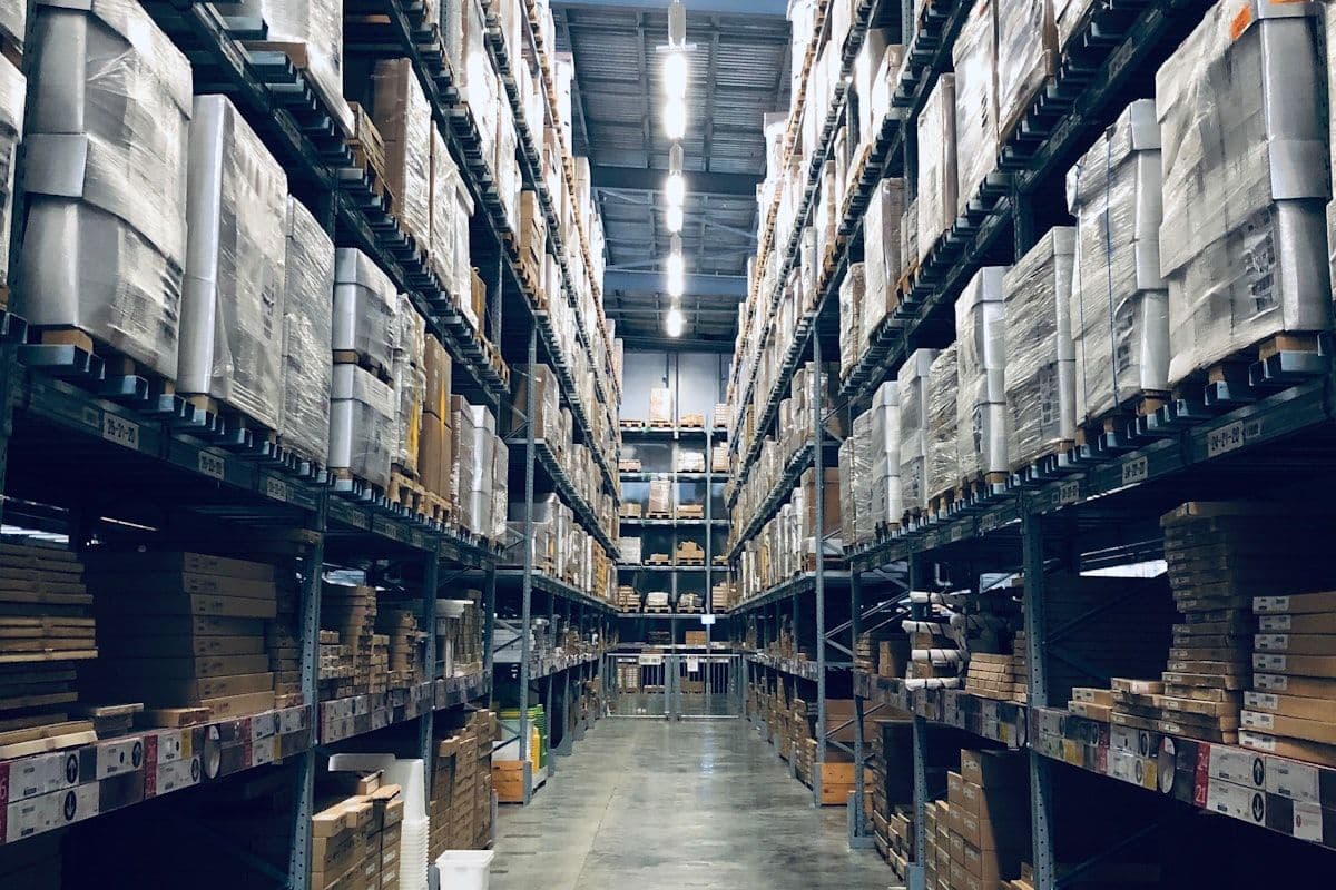
It usually happens on a Tuesday. A new road case shows up at the shop — a custom 6U rack with a drawer underneath, fresh from the case builder. Someone yanks a tape measure off a hook, calls out three numbers to a junior tech with a clipboard, and those numbers get scribbled onto a Post-it. Two weeks later they end up in a pull sheet, three months later in a manifest, two years later in a quote that loses you a tour because the truck count came in 8% too high. The case never changed. The numbers just kept drifting.
If you've spent any time around a touring warehouse, an AVL pre-rig bay, or even a moving company yard, you know that the humble tape measure is the most overworked, least-respected tool in logistics. It's the entry point for every estimate, every pack plan, and every truck count downstream. And it's about to get serious competition from a sensor that ships in the phone in your pocket.
The hidden cost of bad dimensions
Bad dimensional data doesn't usually announce itself. It hides in places that look fine on paper but cost real money in practice. A road case that's logged at 36" deep but actually measures 38" doesn't break anything until you try to fit four of them across the width of a 53-foot trailer and find yourself two inches short. A drum riser that's recorded as 200 lbs when it's really 280 lbs is invisible — until your axle weight comes back hot at the scale house.
Multiply that by the number of cases on a single arena rock tour and you start to see the compounding problem. Most of the entertainment-logistics industry runs on numbers that were measured once, possibly by a tired tech at midnight, and then copy-pasted forward forever. At Pollstar Live! 2026 in April, multiple panels picked at the same scab — production veterans talking about routing that's increasingly tight, freight capacity competition, and the difficulty of capturing institutional knowledge. One panelist's framing stuck with us: "Taking the knowledge, gathering it, putting it in one single place, to then be able to share and communicate it, could almost revolutionize this industry." The dimensions of every case in your shop are exactly that kind of institutional knowledge — currently locked in spreadsheets, sticker labels, and the heads of three senior people.
What actually changed: the LiDAR in your pocket
When Apple put a LiDAR scanner into the iPhone 12 Pro and iPad Pro back in 2020, most of us filed it under "AR gimmick." Five years and several silicon generations later, the picture looks very different. The current crop of LiDAR-equipped iPhones and iPads — the iPhone 15 Pro Max, iPhone 16 Pro, iPad Pro M4 — fire infrared pulses from a VCSEL array and read the return through a depth camera that resolves roughly 256×192 pixels. That's about 49,000 depth points per frame, sampled tens of times per second, with reliable distance readings up to about 10 meters.
What does that mean in plain English? Multiple peer-reviewed studies in the last two years have benchmarked phone LiDAR against terrestrial laser scanners and traditional surveying rigs. Under decent lighting and a steady hand, linear measurements come back within 1–2 centimeters of ground truth on objects up to a few meters across — roughly 1% accuracy on overall dimensions. That's not survey-grade. It is absolutely better than a stressed-out technician with a 25-foot Stanley FatMax at 11 p.m.
The application ecosystem has matured alongside the hardware. Apps like Polycam, Scaniverse, 3D Scanner App, and Canvas now let you capture an entire room — or a single road case — in seconds and export to formats CAD systems actually want. The use cases have spread from real estate and AEC into construction QA, insurance claims, and increasingly, logistics. The underlying capability is no longer in question. The question is what you do with it.
Cargo Measure: closing the gap between gear and load plan
This is the problem we've been chewing on at Backline Logic. We're heads-down on Cargo Measure, a LiDAR-based measurement app currently in development — and the whole reason it exists is the workflow gap between the physical world (a road case sitting on a pallet) and the digital one (a row in your inventory database, a case in your Truck Packer load plan). Today that gap is bridged by humans with tape measures and tribal memory. We think it should be bridged by a 30-second scan.
The intended workflow is simple enough that you can imagine it before you ever open the app:
- Hold your phone or iPad up to the case. Walk around it once.
- The app captures a point cloud, fits a bounding box, and gives you length, width, and height to the nearest centimeter.
- Add weight (from a scale, or estimated from a profile) and a label.
- Push it directly into Truck Packer as a new case — ready to drop into your next pack plan, or save it to a category you can reuse forever.
It's the same idea production managers have been wishing for since the first time they had to manually type a dimension into a CAD program: scan the case, skip the math. We're framing Cargo Measure as the front door to the rest of the load-planning stack — the thing that turns a stack of road cases into a clean, digitally-described inventory in an afternoon, instead of a six-month project that never quite gets finished.
Why this matters for load planning, not just inventory
Truck Packer routinely sees touring operations achieve 30–40% load compaction once they stop estimating cube and start packing against accurate dimensions. The math is brutal: a 5-truck production with a tight pack plan can run on 3 or 4 trucks, which is something on the order of $10,000 a week back into the budget. None of that compaction is achievable if the dimensions you're feeding into the planner are wrong by a couple of inches per case.
Inaccurate dimensions also show up in places you don't expect. Sub-rentals get quoted against the wrong cube. Pre-rig truss orders go out a foot short. Distro packs that should stack three-high in the truck end up two-high because the rolling dolly nobody measured added another two inches. The pull sheet is honest. The numbers behind it aren't.
Phone-based LiDAR doesn't fix every dimension problem in a warehouse, but it changes the economics of measurement enough that you can actually do it. When a tech can scan an entire rack alley before lunch, the case for keeping a clean, current dimensional database goes from "yeah, we should" to "obviously yes."
Beyond touring: movers, exhibitors, and freight brokers
It's tempting to talk about this as an AVL story, because that's where Truck Packer started and where Backline Logic still spends most of its days. But the LiDAR-to-load-plan pipeline isn't an entertainment-only problem. Moving companies are estimating cube on kitchens and living rooms with clipboards and educated guesses. Trade show exhibitors are guessing at booth crate dimensions when they're filling out drayage forms. LTL freight brokers are eating accessorial charges every week because the original dimensions on a bill of lading didn't match what showed up at the dock.
Each of those workflows shares the same root: someone, somewhere, has to measure stuff and feed it into a planning tool. Phone LiDAR collapses the measure step from minutes to seconds, with better accuracy and a perfect audit trail attached. That's not a niche tool. That's a horizontal capability waiting for the right front-end.
The bigger picture: a digital twin you can actually trust
Touring has been talking about "digital twins" of productions for years — every road case, every cable, every sub-rental represented in software so that load plans, drawings, and budgets all draw from the same source of truth. The reason that vision keeps stalling is rarely the planning software. It's the data. Garbage dimensions in, garbage pack plan out.
Device LiDAR is the cheapest, fastest path we've seen to populating that twin with numbers you can actually trust. It's not glamorous. It's not AI. It's a small infrared laser, plus a depth camera, plus a piece of software that knows what to do with the points. But stacked across a thousand road cases, a hundred trailers, and a handful of warehouses, it compounds into something the industry has been trying to build the long way around for a decade.
Where Cargo Measure is right now
Cargo Measure is still in development — we're not announcing a launch date in this post. What we will say is that the prototype already does the thing you'd hope it does: walk around a road case, watch a clean bounding box snap into place, and push the dimensions directly into a Truck Packer pack with a single tap. The remaining work is the unglamorous part: edge cases, bad lighting, oddly-shaped cases with handles and casters, integration polish, and the kind of testing you can only do by handing it to working road dogs and asking them to break it.
If you run a touring shop, a corporate AV warehouse, a moving company, or any operation where stuff needs to be measured and packed for a living, and you'd like to be on the early feedback list — we'd love to hear from you. The fastest way to make Cargo Measure useful is to put it in the hands of people who already know what "useful" looks like.
And if you're already running pack plans in Truck Packer with hand-measured cases: we'd encourage you to keep going. The 3D planner doesn't care whether your dimensions came from a tape measure or a laser. It cares that they're right. Cargo Measure is just the next step toward making "right" the path of least resistance.
Ready to build your load plan? Log in to Truck Packer and pack it.